Dominion Atlantic Railway Digital Preservation Initiative - Wiki
Use of this site is subject to our Terms & Conditions.
Uploads by Paul Charland
From DARwiki
This special page shows all uploaded files.
| Date | Name | Thumbnail | Size | Description | Versions |
|---|---|---|---|---|---|
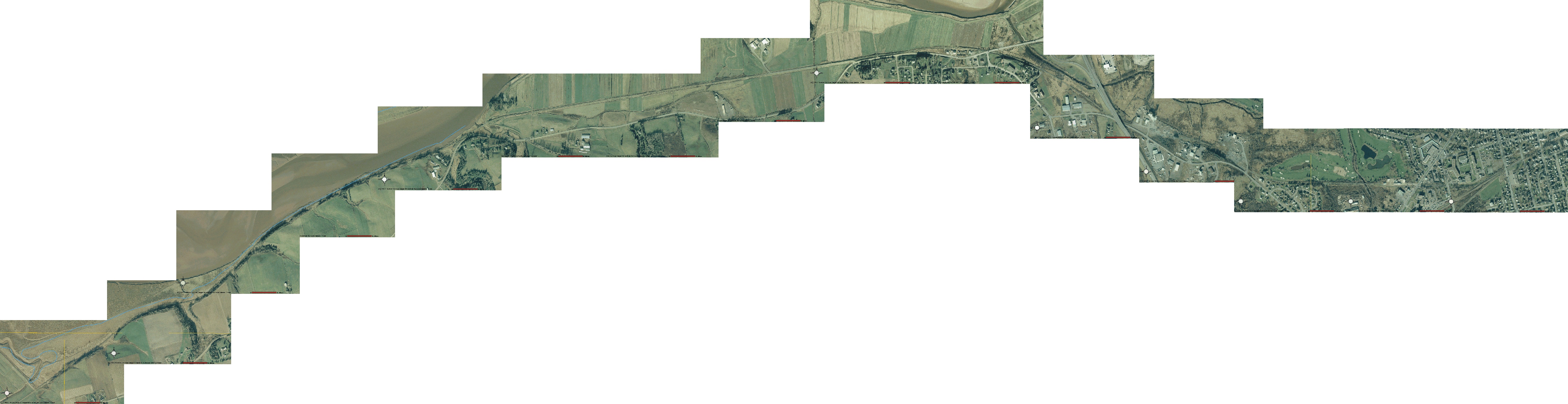
| 17:51, 16 May 2008 | DAR Kingston-Aylesford.jpg (file) |  |
1.56 MB | Kingston to Aylesford, Google Earth screen shots stitched together. This is an older series of shots before Google replaced the images with lower resolution shots that include clouds that obscure some areas. | 1 |
| 17:49, 16 May 2008 | DAR Kingston-Greenwood.jpg (file) |  |
2.05 MB | Kingston to Greenwood, north and south, Google Earth screen shots stitched together. This is an older series of shots before Google replaced the images with lower resolution shots that include clouds that obscure some areas. | 1 |
| 17:47, 16 May 2008 | DAR Wilmot-Kingston.jpg (file) |  |
2.45 MB | Wilmot to Kingston Google Earth screen shots stitched together. This is an older series of shots before Google replaced the images with lower resolution shots that include clouds that obscure some areas. | 1 |
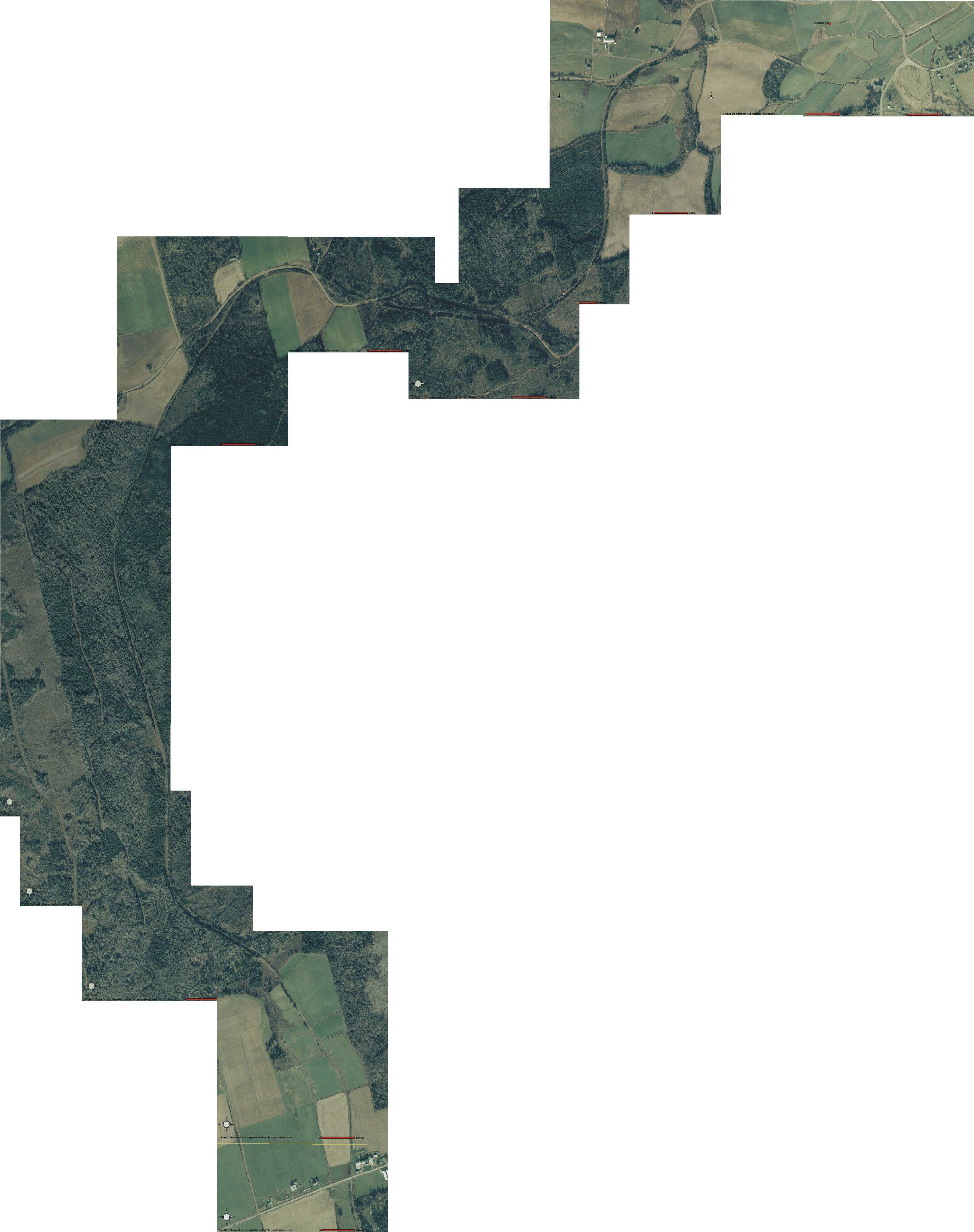
| 05:02, 2 May 2008 | DARPrinceportRdSMaitland.jpg (file) |  |
1.21 MB | Map 03 Prince Port Road to South Maitland After hurricane Juan the government of Nova Scotia commissioned an aerial survey to find the extent of damage to forests. Part of the survey covered the former DAR right of way and I've stitch the what was avail | 1 |
| 05:00, 2 May 2008 | DAROldBarnsPrinceportRd.jpg (file) |  |
1.21 MB | Map 02 Old Barns to Prince Port Road After hurricane Juan the government of Nova Scotia commissioned an aerial survey to find the extent of damage to forests. Part of the survey covered the former DAR right of way and I've stitch the what was available | 1 |
| 04:59, 2 May 2008 | DARTruroOldBarns.jpg (file) | 1.1 MB | Map 01 Truro to Old Barns After hurricane Juan the government of Nova Scotia commissioned an aerial survey to find the extent of damage to forests. Part of the survey covered the former DAR right of way and I've stitch the what was available into four m | 1 | |
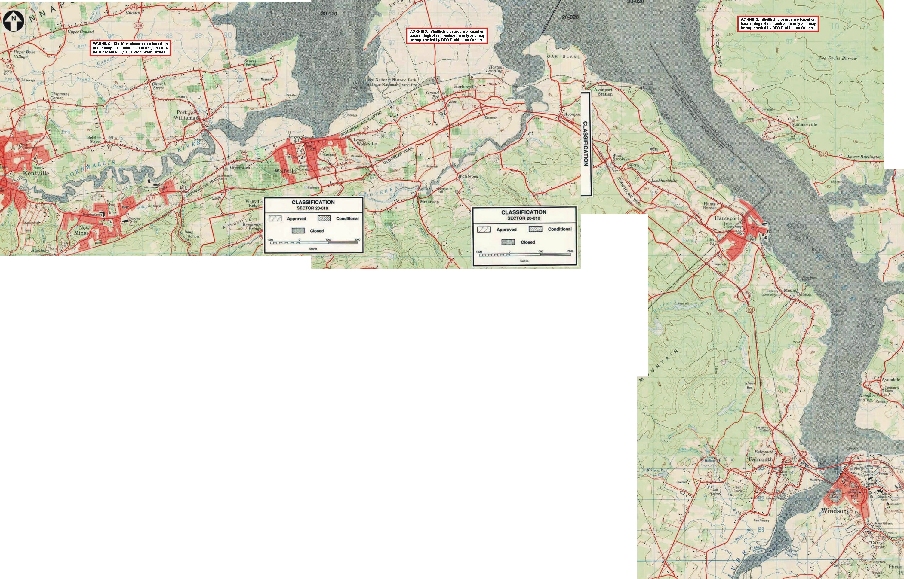
| 10:30, 1 May 2008 | DARKtoWMap1.8MB.jpg (file) |  |
1.81 MB | Nova Scotia Department of Fisheries maps stitched together to form one large scale map from Kentville to Windsor (all that were available at the time). | 1 |