Dominion Atlantic Railway Digital Preservation Initiative - Wiki
Use of this site is subject to our Terms & Conditions.
File:HA-12.77 Mount Uniacke Track Chart.JPG
From DARwiki

Size of this preview: 780 × 600 pixels. Other resolutions: 312 × 240 pixels | 1,951 × 1,500 pixels.
Original file (1,951 × 1,500 pixels, file size: 488 KB, MIME type: image/jpeg)
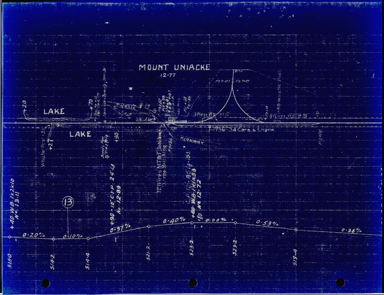
Track schematic for Mount Uniacke, showing the Mount Uniacke Station and a wye, undated. The orientation of the track is west to the left (looking from the south).
File history
Click on a date/time to view the file as it appeared at that time.
| Date/Time | Thumbnail | Dimensions | User | Comment | |
|---|---|---|---|---|---|
| current | 23:57, 17 February 2020 | | 1,951 × 1,500 (488 KB) | Stem (talk | contribs) | |
| 21:07, 4 January 2020 | 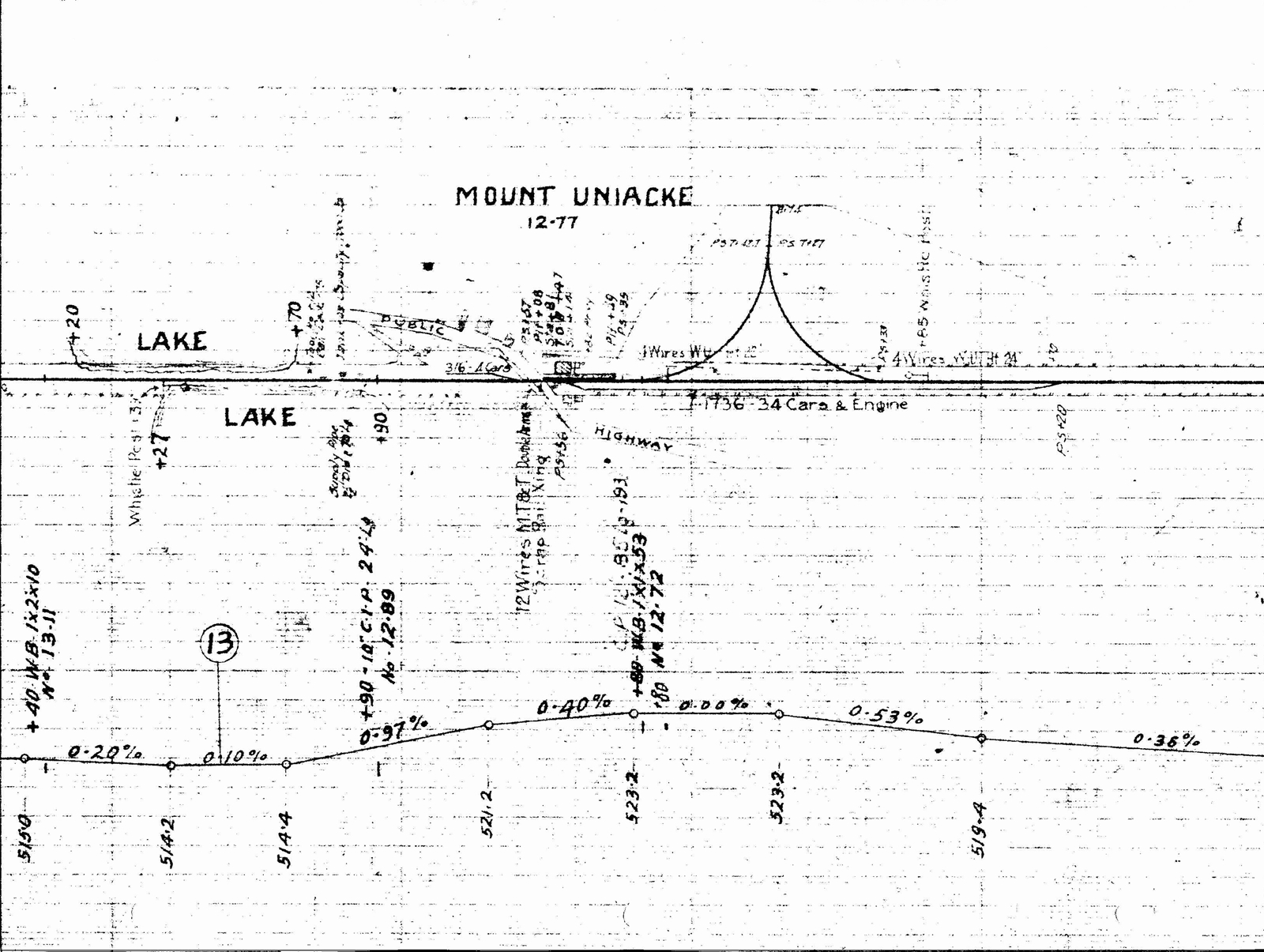 | 1,600 × 1,205 (902 KB) | Dan conlin (talk | contribs) | Track schematic for Mount Uniacke, showing the Mount Uniacke Station and a wye, undated. *Ken McIlvoy collection Category:Ken McIlvoy Collection Category:Track Charts |
You cannot overwrite this file.
File usage
The following 2 pages use this file: