Dominion Atlantic Railway Digital Preservation Initiative - Wiki
Use of this site is subject to our Terms & Conditions.
File:Windsor Rail Lines pre-1956.jpg
From DARwiki
Size of this preview: 800 × 450 pixels. Other resolutions: 320 × 180 pixels | 1,920 × 1,080 pixels.
Original file (1,920 × 1,080 pixels, file size: 240 KB, MIME type: image/jpeg)
Summary
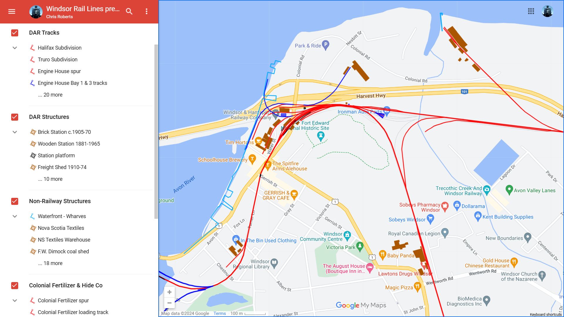
Screenshot of an interactive map that superimposes the DAR lines in the Town of Windsor in 1955 (red) over current roadways and streets. The map also shows railway structures and businesses served by rail (both in brown). Tracks and structures that were present in the early part of the 20th century but removed or demolished prior to 1955 are shown in blue. The riverfront and wharves are shown for reference.
File history
Click on a date/time to view the file as it appeared at that time.
| Date/Time | Thumbnail | Dimensions | User | Comment | |
|---|---|---|---|---|---|
| current | 18:36, 17 November 2024 | | 1,920 × 1,080 (240 KB) | MP32 Halifax (talk | contribs) | Screenshot of an interactive map that superimposes the Dominion Atlantic Railway (DAR) lines in the Town of Windsor in 1955 (red) over current roadways and streets. The map also shows railway structures and businesses served by rail (both in brown). Tracks and structures that were present in the early part of the 20th century but removed or demolished prior to 1955 are shown in blue. The riverfront and wharves as they existed in 1955 are shown for reference. |
You cannot overwrite this file.
File usage
The following page uses this file: