Dominion Atlantic Railway Digital Preservation Initiative - Wiki
Use of this site is subject to our Terms & Conditions.
File:Windsor 1941 Sheet2.jpg
Original file (1,632 × 1,733 pixels, file size: 808 KB, MIME type: image/jpeg)
Summary
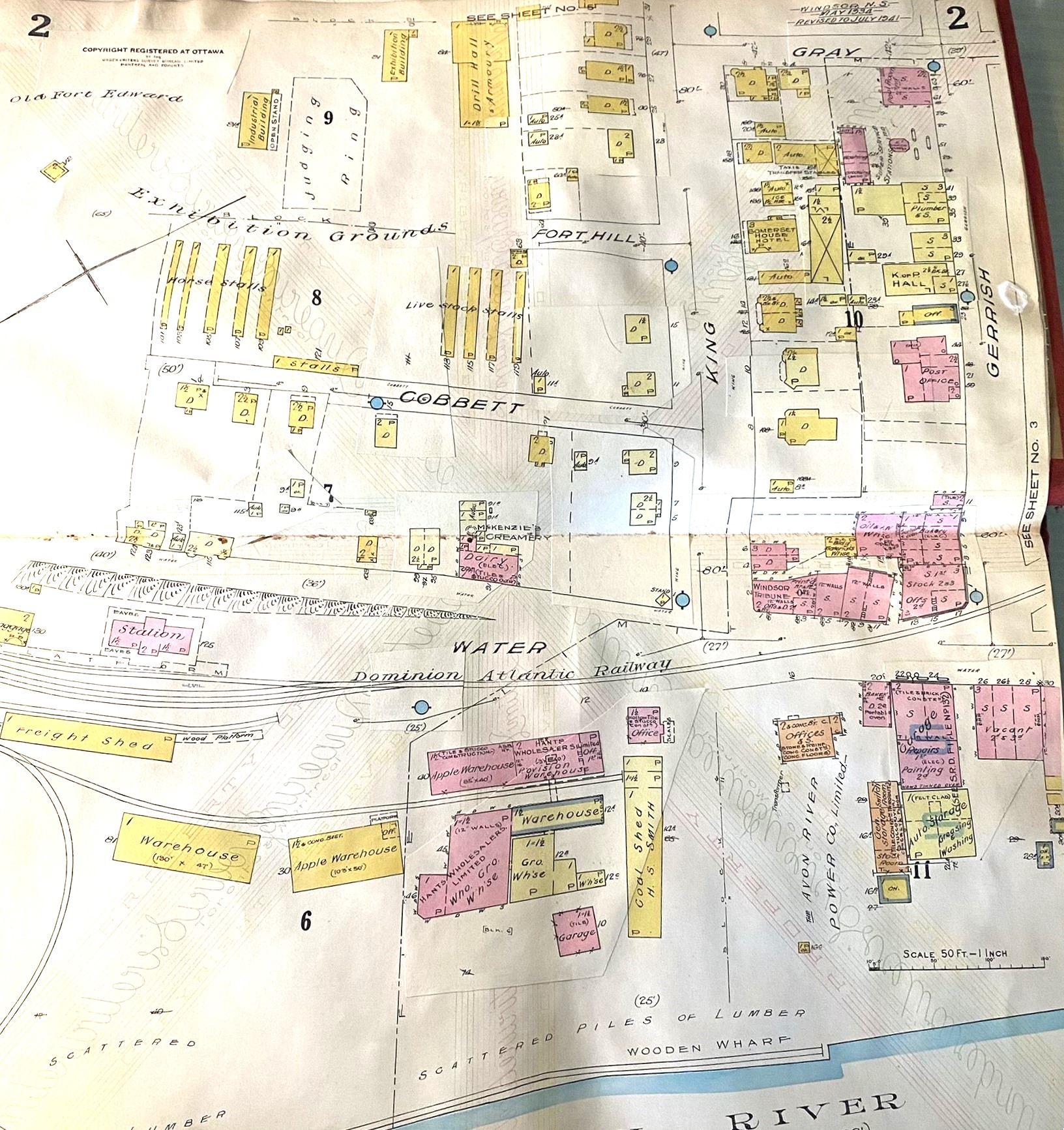
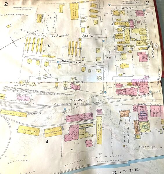
Windsor Fire Insurance Map, Sheet 2, showing the area around the Windsor Station with the Windsor Freight Shed, part of the Windsor Railyard, the L. A. Armstrong Apple Warehouse and the B. Sexton Apple Warehouse. The original map was made in May 1934 and updated to July 1941.
Note: Fire insurance plans provide detailed information on structures and approximate information on track layout. See the railway's Track Charts for precise information on track switches and siding.
Courtesy Irvin Leopold, photographed from Fire Insurance Album owned by Eric Stephens and shared in a May 17, 2024 Facebook Post
File history
Click on a date/time to view the file as it appeared at that time.
| Date/Time | Thumbnail | Dimensions | User | Comment | |
|---|---|---|---|---|---|
| current | 20:08, 19 May 2024 | | 1,632 × 1,733 (808 KB) | Dan Conlin (talk | contribs) | Windsor Fire Insurance Map, Sheet 2, showing the area around the Windsor Station with the Windsor Freight Shed, part of the Windsor Railyard, the L. A. Armstrong Apple Warehouse and the B. Sexton Apple Warehouse. The original map was made in May 1934 and updated to July 1941. Note: Fire insurance plans provide detailed information on structures and approximate information on track layout. See the railway's [[:Category:Track_Charts|Track Chart... |
You cannot overwrite this file.
File usage
The following 6 pages use this file: