Dominion Atlantic Railway Digital Preservation Initiative - Wiki
Use of this site is subject to our Terms & Conditions.
File:HA-10.19 South Uniacke Track Chart.JPG
From DARwiki
Size of this preview: 779 × 600 pixels. Other resolutions: 312 × 240 pixels | 1,948 × 1,500 pixels.
Original file (1,948 × 1,500 pixels, file size: 230 KB, MIME type: image/jpeg)
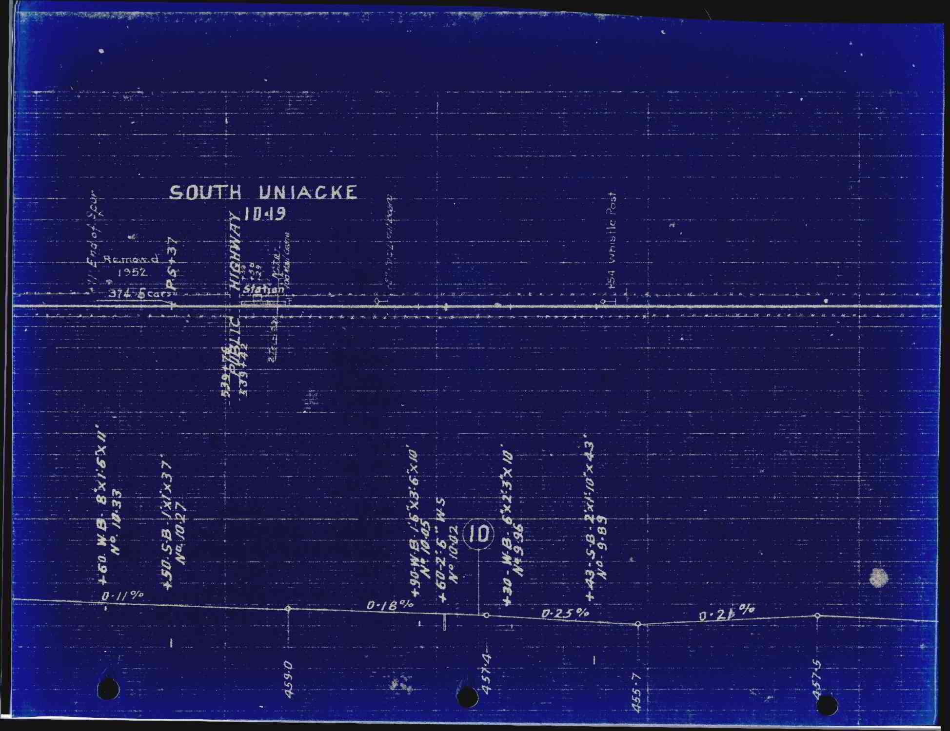
A clip of the March 18, 1918 C.P.R. track profile drawing showing South Uniacke. The orientation of the track is west to the left (looking from the south). The most recent update, for the removal of the siding, is dated 1952.
File history
Click on a date/time to view the file as it appeared at that time.
| Date/Time | Thumbnail | Dimensions | User | Comment | |
|---|---|---|---|---|---|
| current | 13:26, 23 February 2020 | | 1,948 × 1,500 (230 KB) | Stem (talk | contribs) | |
| 20:24, 4 January 2020 | 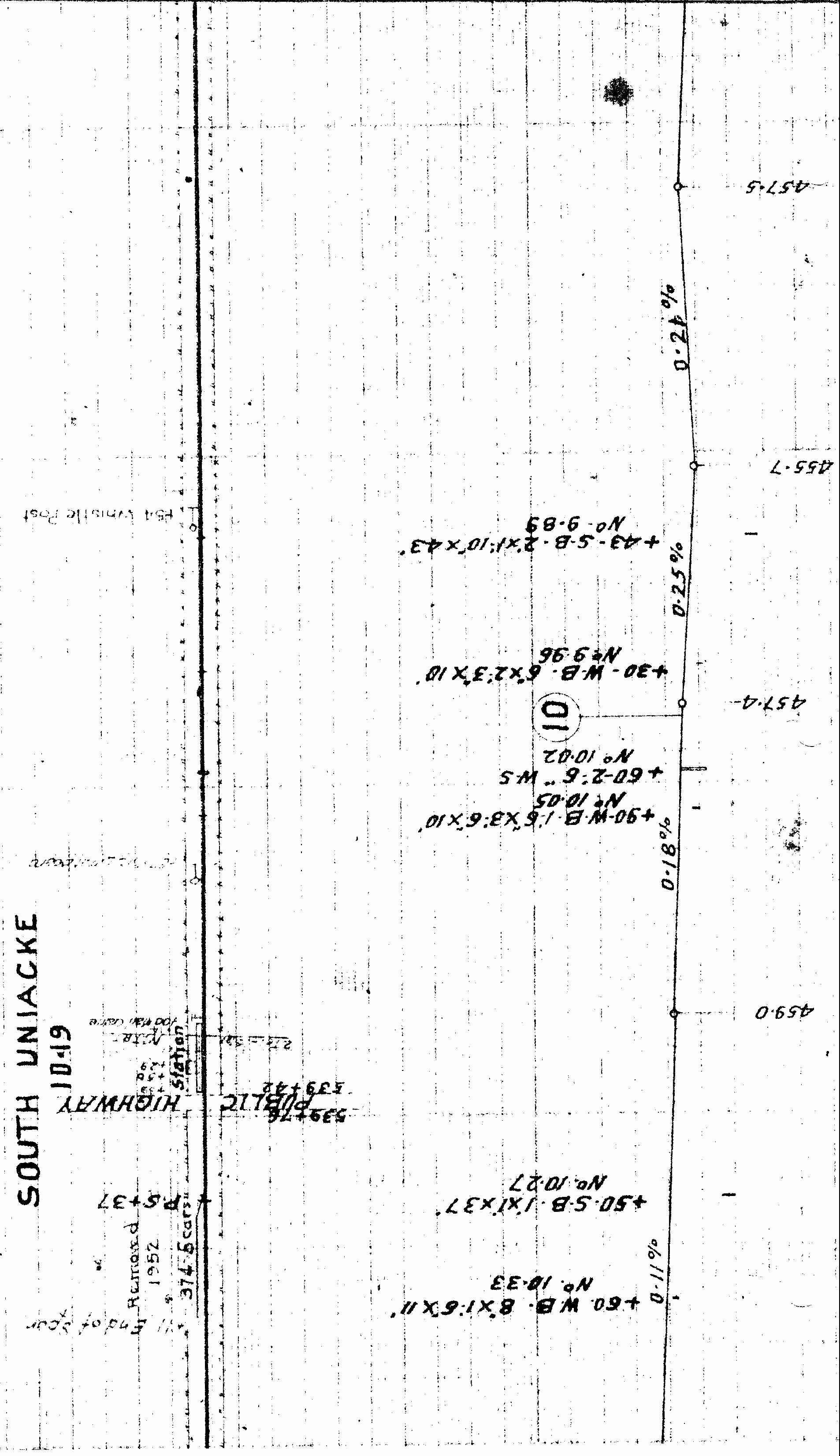 | 3,304 × 1,906 (712 KB) | Dan conlin (talk | contribs) | Track schematic for South Uniacke. The most recent update, for the removal of the sideing, is dated 1955. *Ken McIlvoy collection Category:Ken McIlvoy Collection Category:Track Charts |
You cannot overwrite this file.
File usage
The following page uses this file: