Dominion Atlantic Railway Digital Preservation Initiative - Wiki
Use of this site is subject to our Terms & Conditions.
File:DARKtoWMap1.8MB.jpg
From DARwiki
Size of this preview: 800 × 513 pixels. Other resolutions: 320 × 205 pixels | 3,006 × 1,927 pixels.
Original file (3,006 × 1,927 pixels, file size: 1.81 MB, MIME type: image/jpeg)
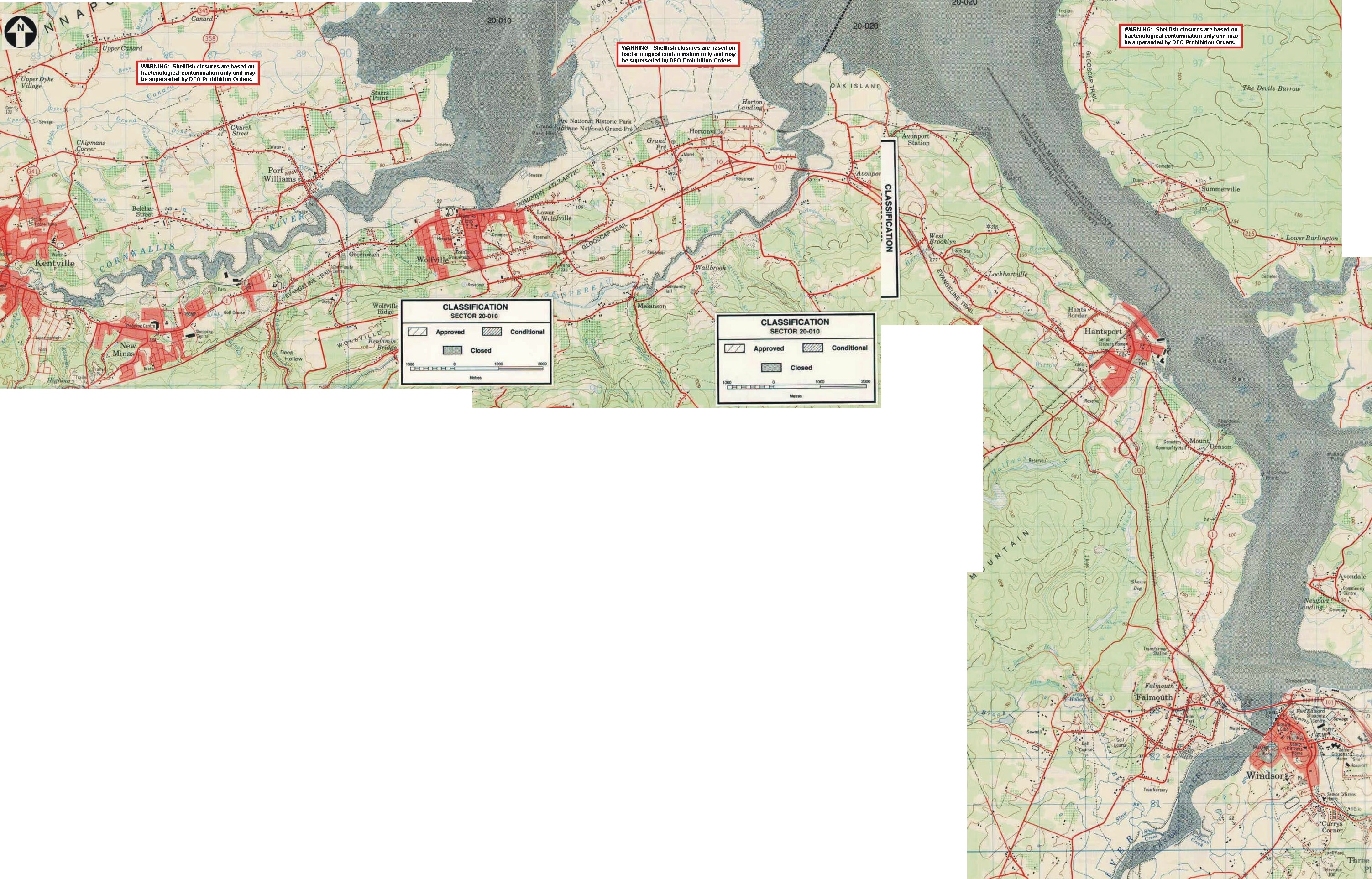
Environment Canada shellfish classification maps stitched together to form one large scale map from Kentville to Windsor (all that were available at the time) post 1970 as the Avon River Causeway is already on the map.
File history
Click on a date/time to view the file as it appeared at that time.
| Date/Time | Thumbnail | Dimensions | User | Comment | |
|---|---|---|---|---|---|
| current | 09:30, 1 May 2008 | | 3,006 × 1,927 (1.81 MB) | Paul Charland (talk | contribs) | Nova Scotia Department of Fisheries maps stitched together to form one large scale map from Kentville to Windsor (all that were available at the time). |
You cannot overwrite this file.
File usage
The following page uses this file: