Dominion Atlantic Railway Digital Preservation Initiative - Wiki
Use of this site is subject to our Terms & Conditions.
File:2008.002.85medres.jpg
From DARwiki

Size of this preview: 800 × 510 pixels. Other resolutions: 320 × 204 pixels | 2,000 × 1,274 pixels.
Original file (2,000 × 1,274 pixels, file size: 1.61 MB, MIME type: image/jpeg)
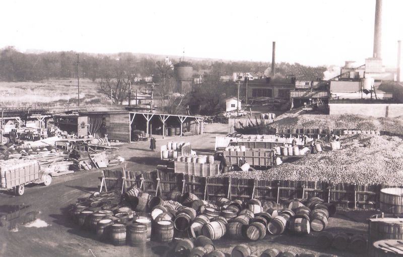
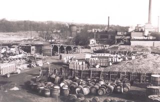
The north side of the Canada Foods Plant in full swing during the busy harvest season in 1949, looking east with the backwall and smokejacks of stalls 8, 9 &10 of the Kentville Roundhouse. The Kentville Water Tower can be seen at its final, river-side location, along with the Kentville Cornwallis River Bridge in the centre and the Spillway Trestle to the left.
- Kings Historical Society Accession No. 2008.002.85
File history
Click on a date/time to view the file as it appeared at that time.
| Date/Time | Thumbnail | Dimensions | User | Comment | |
|---|---|---|---|---|---|
| current | 15:41, 16 October 2017 | | 2,000 × 1,274 (1.61 MB) | Dan conlin (talk | contribs) | The north side of the Canada Foods Plant in full swing during the busy harvest season, looing east with the backwall stalls 9 and 10 of the Kentville Roundhouse and the Kentville Water Tower at its later river-side location, 1949. *[[:Categor |
You cannot overwrite this file.
File usage
The following 5 pages use this file: