Dominion Atlantic Railway Digital Preservation Initiative - Wiki
Use of this site is subject to our Terms & Conditions.
File:HalifaxStation1878.jpg
From DARwiki
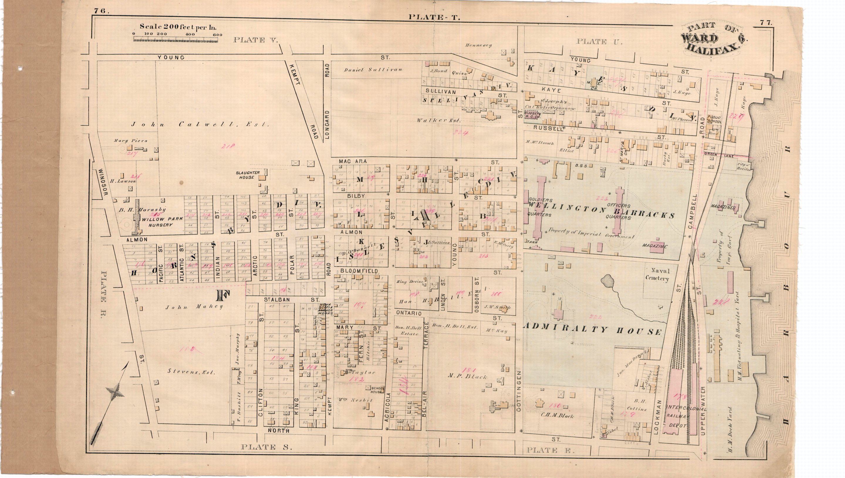
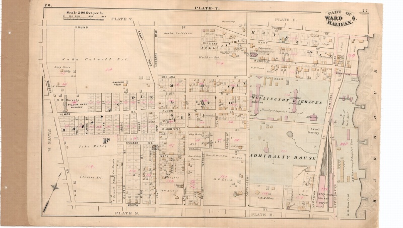
Revision as of 13:52, 22 December 2011 by Engineeral (talk | contribs) (A property map from 1878 showing the Intercolonial Railway Depot at North Street, Halifax. Also shows the alignment and track arrangements to the north. This station was in use by the Dominion Atlantic until 1920. A plate from City Atlas of Halifax, Nova )
Size of this preview: 800 × 453 pixels. Other resolutions: 320 × 181 pixels | 2,879 × 1,629 pixels.
Original file (2,879 × 1,629 pixels, file size: 810 KB, MIME type: image/jpeg)
A property map from 1878 showing the Intercolonial Railway Depot at North Street, Halifax. Also shows the alignment and track arrangements to the north. This station was in use by the Dominion Atlantic until 1920. A plate from City Atlas of Halifax, Nova Scotia, Provincial Surveying and Pub. Co., 1878, source Halifax Regional Municipality.
File history
Click on a date/time to view the file as it appeared at that time.
| Date/Time | Thumbnail | Dimensions | User | Comment | |
|---|---|---|---|---|---|
| current | 13:52, 22 December 2011 | | 2,879 × 1,629 (810 KB) | Engineeral (talk | contribs) | A property map from 1878 showing the Intercolonial Railway Depot at North Street, Halifax. Also shows the alignment and track arrangements to the north. This station was in use by the Dominion Atlantic until 1920. A plate from City Atlas of Halifax, Nova |
You cannot overwrite this file.
File usage
The following page uses this file: