Dominion Atlantic Railway Digital Preservation Initiative - Wiki
Use of this site is subject to our Terms & Conditions.
File:HA-10.19 South Uniacke Track Chart.JPG
From DARwiki
Revision as of 13:29, 23 February 2020 by Stem (talk | contribs) (Stem moved page File:HA-10.20 South Uniacke Track Chart.JPG to File:HA-10.19 South Uniacke Track Chart.JPG)
Size of this preview: 779 × 600 pixels. Other resolutions: 312 × 240 pixels | 1,948 × 1,500 pixels.
Original file (1,948 × 1,500 pixels, file size: 230 KB, MIME type: image/jpeg)
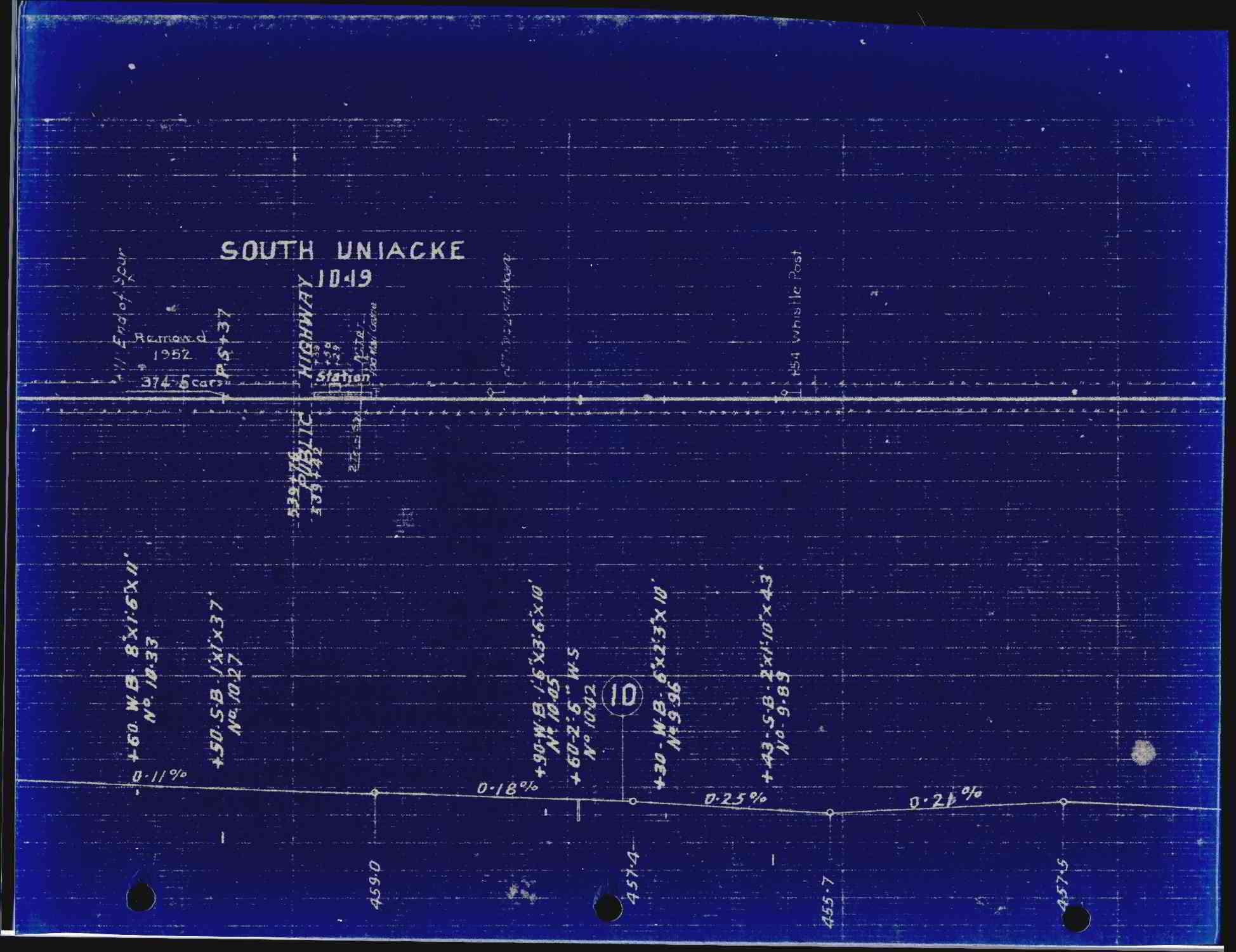
Track schematic for South Uniacke. The most recent update, for the removal of the siding, is dated 1955.
File history
Click on a date/time to view the file as it appeared at that time.
| Date/Time | Thumbnail | Dimensions | User | Comment | |
|---|---|---|---|---|---|
| current | 13:26, 23 February 2020 | | 1,948 × 1,500 (230 KB) | Stem (talk | contribs) | |
| 20:24, 4 January 2020 | 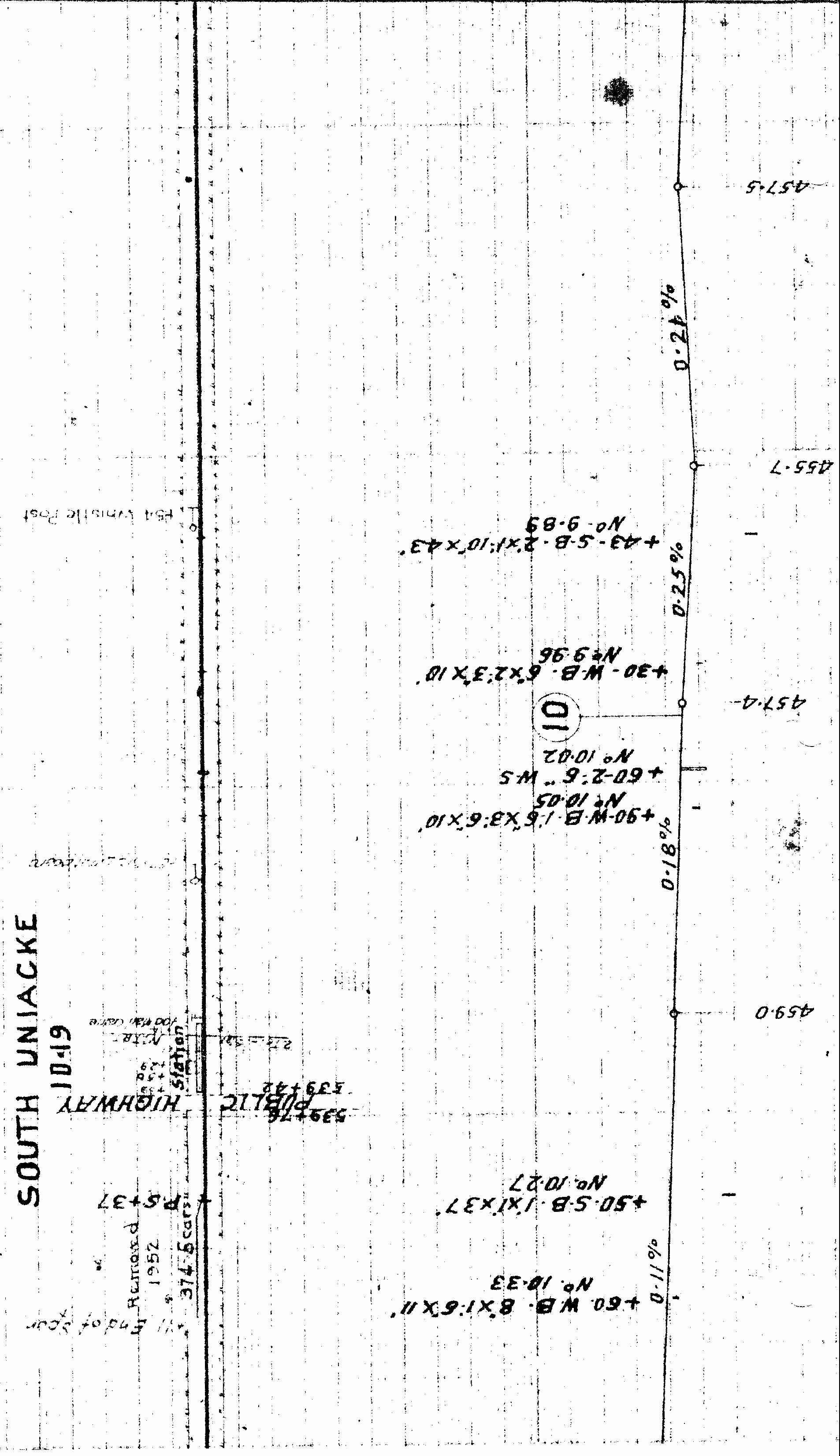 | 3,304 × 1,906 (712 KB) | Dan conlin (talk | contribs) | Track schematic for South Uniacke. The most recent update, for the removal of the sideing, is dated 1955. *Ken McIlvoy collection Category:Ken McIlvoy Collection Category:Track Charts |
You cannot overwrite this file.
File usage
The following page uses this file: