Dominion Atlantic Railway Digital Preservation Initiative - Wiki
Use of this site is subject to our Terms & Conditions.
Difference between revisions of "Deep Brook"
From DARwiki
Dan conlin (talk | contribs) (→Gallery: images) |
Dan conlin (talk | contribs) (image) |
||
| Line 6: | Line 6: | ||
==Features and Facilities== | ==Features and Facilities== | ||
[[:Category:Gypsum_Trains|Gypsum Loading Facilities]] | [[:Category:Gypsum_Trains|Gypsum Loading Facilities]] | ||
| − | |||
==Gallery== | ==Gallery== | ||
| Line 13: | Line 12: | ||
Image:Deep Brook Shed a.jpg|The gypsum storage shed and dock at Deep Brook. | Image:Deep Brook Shed a.jpg|The gypsum storage shed and dock at Deep Brook. | ||
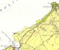
File:DeepBrookGypsumLoaderMap.jpg|Map showing the Gypsum loader spur and dock. | File:DeepBrookGypsumLoaderMap.jpg|Map showing the Gypsum loader spur and dock. | ||
| + | File:DAR - Deep Brook Station Sign Only-Harold Jenkins Photo-18November1962.JPG|[[Deep Brook]] station sign, November 18, 1962. | ||
File:DeepBrookGypsumLoader.jpg|Aerial View showing the remnants of the Gypsum loader spur and dock. | File:DeepBrookGypsumLoader.jpg|Aerial View showing the remnants of the Gypsum loader spur and dock. | ||
</Gallery> | </Gallery> | ||
Revision as of 18:07, 15 October 2018
Deep Brook, Nova Scotia
- Subdivision Yarmouth, Mile 10.4
- Elevation unknown
- Passing track 915' long.
Features and Facilities
Gallery
Deep Brook station sign, November 18, 1962.


