Dominion Atlantic Railway Digital Preservation Initiative - Wiki
Use of this site is subject to our Terms & Conditions.
Difference between revisions of "File:DARCornwallisStationMap'80.jpg"
From DARwiki
(CFS Cornwallis Station map. This was a large map with 3D buildings under glass on the east side of the station... you can see it in the east side shot if you look under the train order signal remains. Not sure why it was there, civilians were not allowe) |
|||
| Line 1: | Line 1: | ||
CFS Cornwallis Station map. This was a large map with 3D buildings under glass on the east side of the station... you can see it in the east side shot if you look under the train order signal remains. Not sure why it was there, civilians were not allowed to detrain at Cornwallis, just Canadian Forces member in uniform. I think if you made it that far into training that you could take a train back to the base you probably wouldn't need a map to find your barracks! | CFS Cornwallis Station map. This was a large map with 3D buildings under glass on the east side of the station... you can see it in the east side shot if you look under the train order signal remains. Not sure why it was there, civilians were not allowed to detrain at Cornwallis, just Canadian Forces member in uniform. I think if you made it that far into training that you could take a train back to the base you probably wouldn't need a map to find your barracks! | ||
| + | |||
| + | *[[:Category:Paul Charland Photo|Paul Charland photo]] | ||
| + | |||
| + | [[Category:Paul Charland Photo]] | ||
Latest revision as of 17:12, 10 October 2010
CFS Cornwallis Station map. This was a large map with 3D buildings under glass on the east side of the station... you can see it in the east side shot if you look under the train order signal remains. Not sure why it was there, civilians were not allowed to detrain at Cornwallis, just Canadian Forces member in uniform. I think if you made it that far into training that you could take a train back to the base you probably wouldn't need a map to find your barracks!
File history
Click on a date/time to view the file as it appeared at that time.
| Date/Time | Thumbnail | Dimensions | User | Comment | |
|---|---|---|---|---|---|
| current | 06:49, 10 October 2010 | 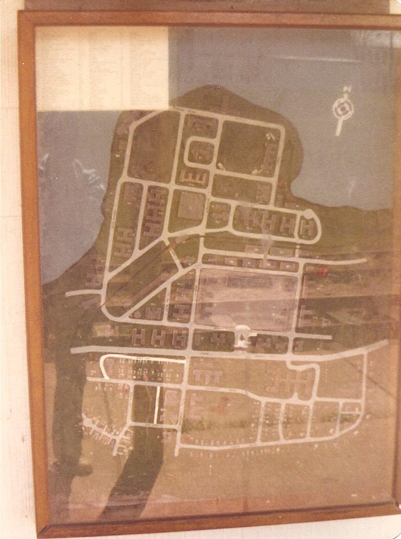 | 800 × 1,076 (292 KB) | Paul charland (talk | contribs) | CFS Cornwallis Station map. This was a large map with 3D buildings under glass on the east side of the station... you can see it in the east side shot if you look under the train order signal remains. Not sure why it was there, civilians were not allowe |
You cannot overwrite this file.
File usage
The following page uses this file: