Dominion Atlantic Railway Digital Preservation Initiative - Wiki
Use of this site is subject to our Terms & Conditions.
Difference between revisions of "File:DeepBrookGypsumLoaderMap.jpg"
From DARwiki
| Line 1: | Line 1: | ||
| − | + | Topographical map showing the Deep Brook gypsum loader spur and dock. | |
| + | Complete map may be found: [http://www.dardpi.ca/wiki/index.php?title=File:Digby_21_A12_East.jpg] | ||
| + | Transcribed from the forum: [http://www.dardpi.ca/forum/viewtopic.php?f=1&t=891&p=4104#p4104] | ||
Latest revision as of 13:31, 6 May 2017
![[1]](http://www.dardpi.ca/wiki/index.php?title=File:Digby_21_A12_East.jpg)
File history
Click on a date/time to view the file as it appeared at that time.
| Date/Time | Thumbnail | Dimensions | User | Comment | |
|---|---|---|---|---|---|
| current | 13:19, 6 May 2017 | 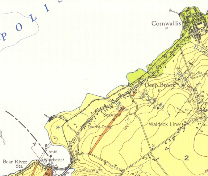 | 674 × 572 (138 KB) | Stem (talk | contribs) |
You cannot overwrite this file.
File usage
The following 2 pages use this file: