Dominion Atlantic Railway Digital Preservation Initiative - Wiki
Use of this site is subject to our Terms & Conditions.
Category:Tourism Maps
From DARwiki
Revision as of 19:33, 11 July 2024 by Dan Conlin (talk | contribs) (Created page with "__NOTOC____NOTITLE__ =Tourism Maps= Maps made to promote travel along the Dominion Atlantic Railway Category:Maps")
Tourism Maps
Maps made to promote travel along the Dominion Atlantic Railway
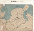
Media in category "Tourism Maps"
The following 13 files are in this category, out of 13 total.
 19110625-DARPTT 09-10.jpg 2,126 × 1,200; 792 KB
 1914 DAR Brochure 08.jpg 709 × 792; 191 KB
 19230701-DARPTT 3.jpg 2,481 × 2,414; 1.78 MB
 1923Brochure019.jpg 4,721 × 2,927; 7.58 MB
 19431105-DARPTT P1.jpg 1,800 × 869; 217 KB
 201402101.jpg 1,670 × 1,528; 412 KB
 Bostonmaritimepr00domi 0011.jpg 3,000 × 2,668; 6.35 MB
 Fundy 7.jpg 760 × 677; 296 KB
 Hunting and Fishing 1919 37.jpg 935 × 753; 257 KB
 Hunting and Fishing 1919 38.jpg 624 × 764; 205 KB
 Hunting and Fishing 1919 39.jpg 1,192 × 790; 433 KB
 June 1, 1937 public TT.3.jpg 2,127 × 1,374; 845 KB
 Vacation Days 34.jpg 674 × 741; 231 KB


